Last Updated on May 3, 2019 by Aminul Haque Shahin
Do you know what the total area of Bangladesh is?
Do you know where Dhaka Division is located?
Bangladesh, the South Asian country, has a total area of 56,977 square miles (1,48,393 square kilometers). According to the 2011 census, the country has a vast population of 142,319,000, making the country one of the most densely populated countries in the world.
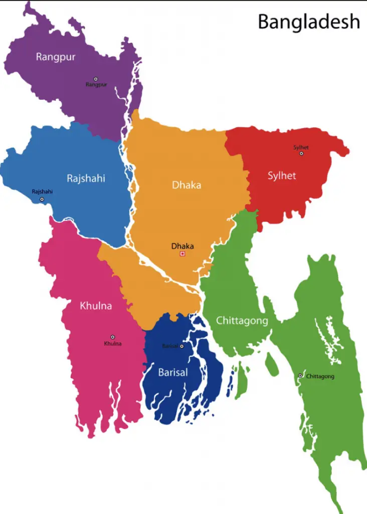
The map of Bangladesh consists of divisions and districts marked separately. The country has 8 divisions and 64 districts.
Bangladesh is a sovereign country, bordering with India from West, North, and East. Myanmar is located on the southeast side of Bangladesh. And, the Bay of Bengal is located in the South.
Jump To The Right Section
- 1 Map of Bangladesh
- 2 Bangladesh Divisional Map
- 2.1 Barishal Division of Bangladesh
- 2.2 Chittagong Division in Bangladesh Map
- 2.3 Dhaka Division in Bangladesh Map
- 2.4 Khulna Division in Map of Bangladesh
- 2.5 New Mymensingh Division location in Bangladesh Map
- 2.6 North area Bangladeshi Map with Rajshahi Division
- 2.7 Rangpur Division in Map of BD
- 2.8 Sylhet Divisional Map With Information
- 3 The position of Divisions of Bangladesh in the Map
Map of Bangladesh
This Bangladesh Map shows the geographic locations of Dhaka city and other major cities, districts and political divisions of the country. Dhaka is the capital of the country, located in the center of the map. Dhaka City is located on the banks of the Buriganga River.
The capital Dhaka is known as the City of Mosques.
Bangladesh Divisional Map
Bangladesh currently has 8 divisions. The 8 divisions are Dhaka, Chittagong, Rajshahi, Khulna, Rangpur, Sylhet, Barisal and Mymensinngh (new division ). Proposed Divisions of the country are Comilla Division and Faridpur Division.
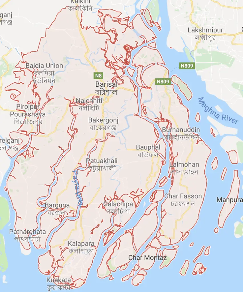
Barishal Division of Bangladesh
- Main City: Barisal
- Districts : 6
- Upazilas: 39
- Union Parishads: 333
- Area: 13,225.20
- Population: 8,325,666
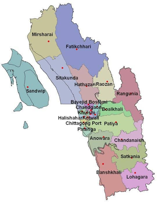
Chittagong Division in Bangladesh Map
- Main City: Chittagong
- Districts: 11
- Upazilas: 97
- Union Parishads: 336
- Area: 33,908.55
- Population: 28,423,019
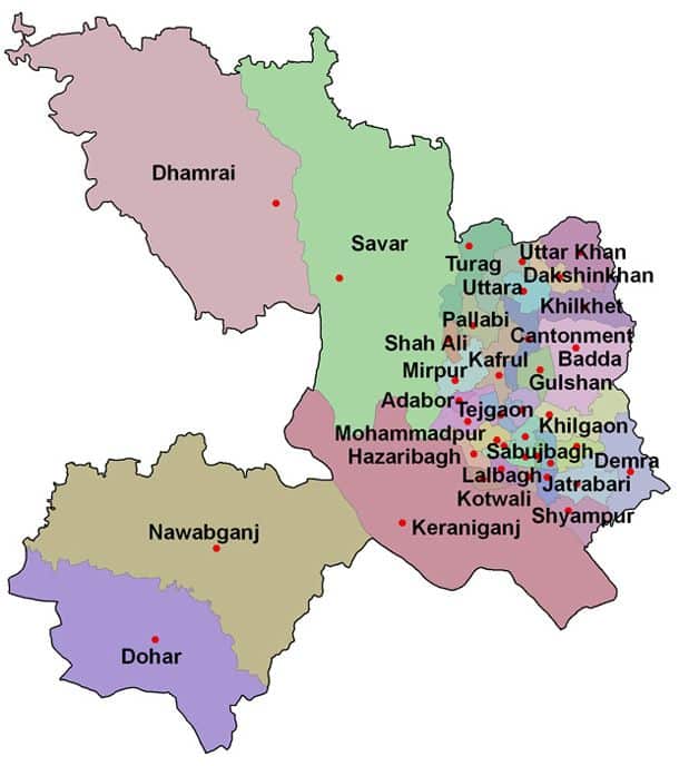
Dhaka Division in Bangladesh Map
- Main City: Dhaka
- Districts: 13
- Upazilas: 93
- Union Parishads: 1833
- Area: 20,593.74
- Population: 36,054,418
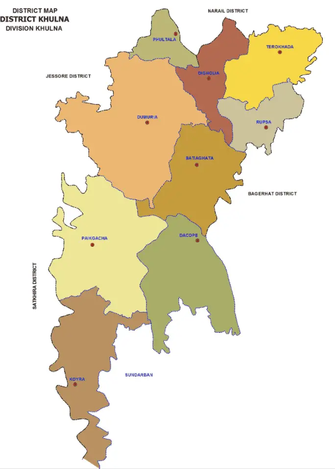
Khulna Division in Map of Bangladesh
- Main City: Khulna
- Districts: 10
- Upazilas: 59
- Union Parishads: 270
- Area: 22,284.22 km2
- Population: 15,687,759
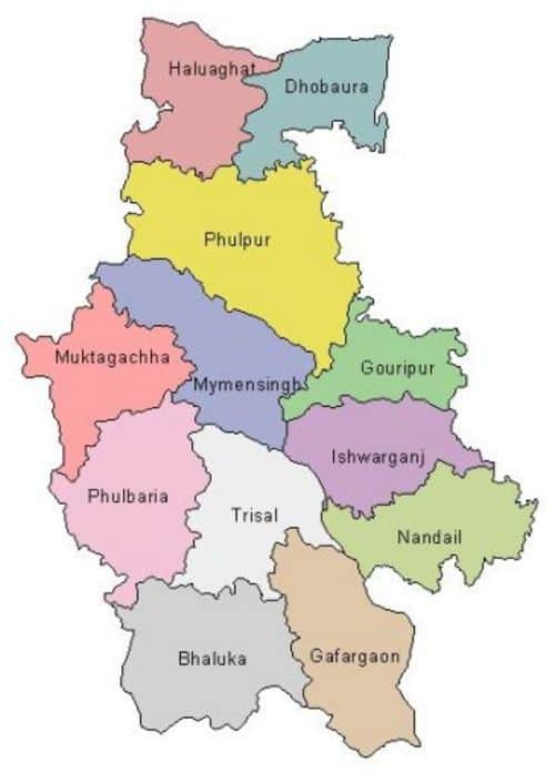
New Mymensingh Division location in Bangladesh Map
- Main City: Mymensingh
- Districts : 4
- Upazilas: 34
- Union Parishads: 350
- Area: 10,584.06 km2
- Population: 11,370,000
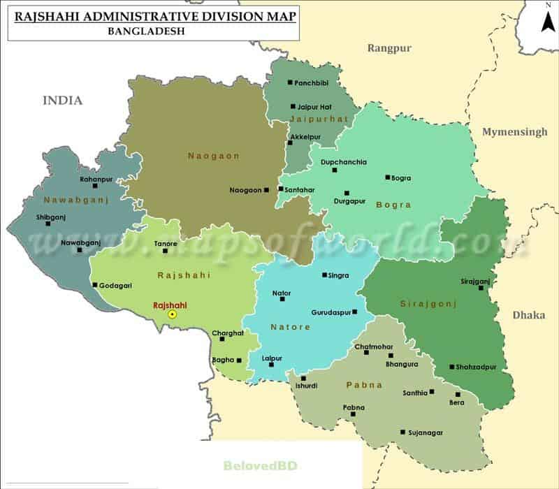
North area Bangladeshi Map with Rajshahi Division
- Main City: Rajshahi
- Total Districts : 8
- Upazilas: 70
- Total Union Parishads: 558
- Area: 18,153.08 km2
- Population of Rajshahi Division: 18,484,858
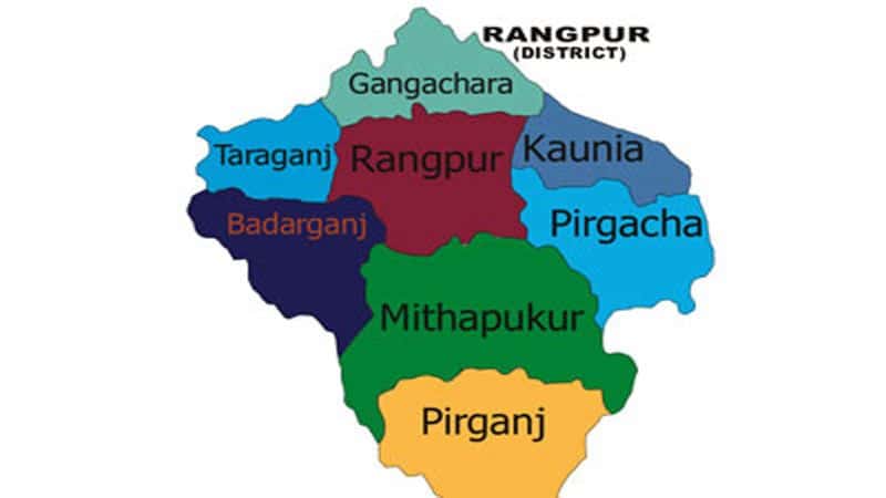
Rangpur Division in Map of BD
- Main City: Rangpur
- Total Districts: 8
- Upazilas: 58
- Total Union Parishads: 536
- Area: 16,184.99 km2
- Population of Rangpur Division: 15,787,758
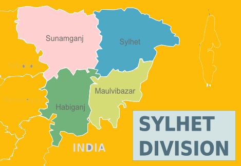
Sylhet Divisional Map With Information
- Main City: Sylhet
- Total Districts: 4
- Upazilas: 38
- Total Union Parishads: 334
- Area: 16,184.99 km2
- Population of Sylhet Division: 9,910,219
The position of Divisions of Bangladesh in the Map
- Dhaka division is located in the middle of Bangladesh with bordering Barisal, Khulna, Comilla, Mymensingh, Rajshahi.
- Rajshahi Division is located in the north-west of Bangladeshi Map with boarding Khulna, Mymensingh and Dhaka.
- Sylhet Division is located in the North-east of Bangladesh Map with bordering Mymensingh and Comilla.
- Chittagong Division can be found in the East-South of Bangladesh map with bordering Barisal and Dhaka.
- Barisal division is in the North of Bangladesh Map with bordering Dhaka, Khulna, and Chittagong.
- Khulna is in the South-west of Bangladesh with bordering Barisal, Rajshahi, and Dhaka.
Bottom Line
The Map of Bangladesh offers concise knowledge on geographic locations of divisions and districts in Bangladesh. Make sure you’re knowledgeable about it. Learn everything about the Map of Bangladesh from this article.