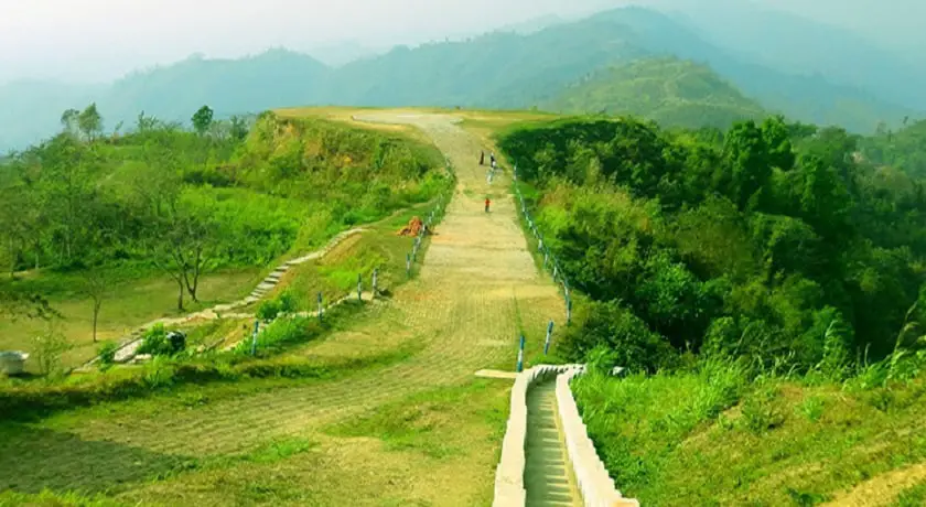

In the south-eastern region of Bangladesh, the only hilly region of Bangladesh, 21 ° 25 ‘north latitude to 23 ° 45′ north latitude and 91 ° 54′ east longitude to 92 ° 50’ east longitude. Myanmar on the southeastern border, the Tripura state of India on the north, Mizoram in the east and Chittagong district on the west. The area of Chittagong Hill Tracts is approximately 23,184 sq km, which is about one-tenth of Bangladesh’s total area.
Climate of Chittagong Hill Tracts of Bangladesh
The weather here is characterized by the tropical monsoon climate. Annual average rainfall is 2540 mm north and east 2540 mm to 3810 mm in south and west. Winter season from November to March. The pre-monsoon season from April to May. It is very hot and sunny. The monsoon season is effective from June to October. The time is hot, cloudy and humid.
Soil, Plants, Flora, fauna
Mountain clay dystric cambisols are mainly yellowish brown to reddish-brown, loamy soil. In different depths, they are broken into sludge rock, sandstone, and mottled sand. This soil is very acidic.
Hilly land is inappropriate for cultivation. But natural plants grow very much. Attempts are being made to cultivate zum on hill slopes. Cotton, rice, tea, and oilseed are being cultivated in the plain plains of the two mountains.
Most of the hills are covered with dense forests, where there are bamboo, cane and chaun (a type of grass) and precious wood resources. The mountains, rivers and steep cliffs of the region are covered with dense bamboos, tall trees, and cilantro. The valleys covered in thick forests. Characteristic plants include semi-evergreen evergreen tree. Notable among these skyscrapers, Diptera Karpasiye, Euphorbesi, Laurashey, Liguminaceae, and Rubiaseyi.
Among the species of the Chittagong Hill Tracts, elephants, monkeys, desi foxes, couples, meteoroids, wild pigs, coughs, lightning-bites, plexus-oysters, rats, birds of prey and other nomadic snakes, various species of lizards and amphibians like frogs and frogs are frozen. Birds of the Chittagong Hill Tracts are very rich. About fifty species of birds are found here.
History
The first published map of Bengal was mentioned in 1550 AD. Of course, in the year 953, a king of Arakan captured the current districts and the Chittagong Hill Tracts. Later, in the year 1240 Tripura king occupied this region. The king of Arakan re-captured the districts in 1575 and retained control till 1666. In the original proposal, the territories of the region were quickly switched between the Tripura and Arakan rulers. The Mughals controlled the area from 1666 to 1760. In the year 760, the area was occupied by the East India Company. The British captured the CHT in 1860 and made it a part of British India. They named it Chittagong Hill Tracts (Chittagong Hill Tracts). The British recorded the Chittagong Hill Tracts as an extended part of Chittagong. The hill hills of the south are known as the hill tracts of Arakan and the northern hills. In administrative form, they brought the Chittagong Hill Tracts under the Province of Bengal. Under the Chittagong Hill Tracts rule of 1900, a local system of taxation was introduced under the leadership of the headmen and the leaders. After the establishment of Pakistan in 1947, the Chittagong Hill Tracts came under the jurisdiction of Pakistan. After the independence of Bangladesh in 1971, it was affiliated with Bangladesh and it marked significant changes and development activities here. As part of the country’s administrative reform in the early eighties, the Chittagong Hill Tracts was divided into three distinct districts. These are Rangamati, Khagrachari and Bandarban districts. On December 2, 1997, the government of Bangladesh signed a peace agreement with the Chittagong Hill Tracts Jana Sanghati Samity. The treaty was instrumental in establishing peace through suppressing the two-decade armed insurgency in the region.
The population of Chittagong Hill Tracts of Bangladesh
Most of the people here belong to the Mongolian category. The main Mongolian tribes are Chakma, Tripura, Murong, and Magh. In fact, 13 indigenous tribals live in the Chittagong Hill Tracts. They are divided into several different groups. According to the 1991 census, the total population was 10.55 thousand 362. Most Chakma and followers of Marma Buddhism, Tripura residents, Hindu religion and Mijo, Vam and Thayang Christians. Some other tribes worship the soul, animals, and plants.
Source: Preliminary Report on Population Census, 1991.
| Race of the population | Total population | Percentage rate |
| Bengali | 5,00,000 | 50% |
| Chakma | 2,40,000 | 24% |
| Marma | 1,43,000 | 14% |
| Tripura | 61,000 | 6% |
| Murong | 22,000 | 2.2% |
| Tanchangata | 19,000 | 1.9% |
| Vom | 7,000 | 0.7% |
| Pangkha | 4,500 | 0.35% |
| Chuck | 2,000 | .000% |
| Khang | 2000 | .00% |
| Khumming | 1,200 | 0.12% |
| Lusai | 662 | — |
| Cookie | (?) |
Communication
Roads and waterways are the main means of communication. The length of the total waterway between Rangamati, Khagrachari and Bandarban districts is 444 km, 640 km, and 166 km respectively. Total pucca road length between Khagrachari and Bandarban district is 134 km and 296 km respectively. Economy
The only gas field in the Chittagong Hill Tracts, the Seemutang gas field located in Khagrachari district. In 1969, the National Oil Company (the then Pakistan Oil and Gas Development Corporation) discovered it. Other natural and mineral resources include sandstone, gondola, calcareous concrete, conglomerate and lignite coal.A paper mill has been established on the bank of Karnaphuli in Chandraghona and a hydroelectric power station has been constructed in Kaptai for power generation. The hill people made traditional cotton yarn, bamboo mesh, and baskets.
